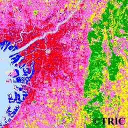
 Land cover classification by using Landsat data (OSAKA)
GO TO: Home| What's New!| About TRIC| About TSIC| Project| Research| Information| Publication| Links
 Land cover classification by using Landsat data (OSAKA)
Copyright(C)TRIC
Copyright(C)1997, by Tokai University Research & Information Center
No reproduction or republication of any contents on TRIC HOME PAGE without written permission
All Rights Reserved
Updated on February 5, 1997